| Events | |
| Int’l Cooperation News | |
| Upcoming Events |
| Location: Home>News>Events |
| Platform B of “UAV-based Remote Sensing Payload Pre-Launch Calibration and Validation System” carried with PolSAR system has successfully completed its flight testing | TEXT SIZE: A A A |
|
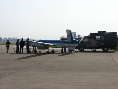
As a key program of the National High Technology Research and Development Program(“863” Program), and led by Earth Observation Technology Application Department, Acedemy of Opto-Electronics ,“UAV-based Remote Sensing Payload Pre-Launch Calibration and Validation System” program has made a significant progress in the South China site flight testing. On June 22nd , the UAV platform B, carried with the high-precision PolSAR system, made a successfully flight testing in an airport of Guizhou, acquired high-quality data of polarimetric SAR. The platform B took off in 16:18, Beijing time, made a fixed-height flight in the height of 3000m altitude and lasted for 90 minutes, it completed the flight assignments of 3 target flight strips and 3 agricultural application flight strips. The instruction stream and data stream was smooth and reliable during the flight, and the PolSAR payload worked well and acquired clear images. The platform touched down safely in 18:34, Beijing time, it had totally acquired about 350GB high-quality SAR echo data, then the working team of data processing and analysis produced the first batch of SAR images immediately after the flight. The targets and surface features could be definitely identified in the images, and the spatial resolution was better than 0.3m, which had fulfilled the predefined object, and laid a good foundation of the PolSAR payload validation afterwards and agricultural demonstration application. The picture below is the processed SAR image of this flight testing.
High-precision PolSAR image(Airport)
|